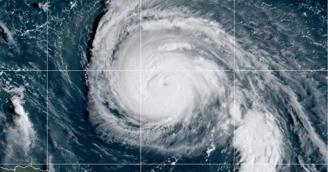
Hurricane Humberto is forecast to head out towards the wider Atlantic Ocean by Wednesday evening, where it would dissipate into a tropical storm – but it could still strike Britain later in the week, with up to 70mph winds in its wake
Hurricane Humberto could trigger a massive storm in Britain this weekend, after wreaking havoc across the Caribbean and the US this week, it’s been claimed. It comes after the UK narrowly avoided the effects of Hurricane Gabrielle that slammed into Portugal last week.
The remnants of the Category 4 hurricane could travel across the Atlantic Ocean, heading straight for the UK. This would likely result in the first named storm of the season for Britain, which would be Storm Amy, bringing heavy winds and rain – and it could be a “big one”, a weather expert has warned.
Humberto was intensifying in the Caribbean on Monday morning, and is predicted to sweep between the US and Bermuda on Tuesday. Storm trackers anticipated the hurricane to move out toward the broader Atlantic Ocean by Wednesday evening, where it would weaken into a tropical storm.
However, it could still batter Britain later in the week, bringing winds of up to 70mph in its path, according to British Weather Services’ meteorologist Jim Dale. The most northern and western regions of the country would likely bear the brunt, he said.
“Storm Amy looks destined to unfold off the ashes of Humberto on Friday or Saturday, if it all goes to plan. There will be lots of wind and rain.”, he told the Mirror.
“The exact positioning is yet to be determined but a storm is brewing following all of this sedate autumnal weather. The potential is there for it to be a big one.
“There could be 50-70mph winds, and 30-60mm rain. Who gets what remains to be seen. The northern and western areas are likely most prone to the storm, though.”
The Met Office has confirmed that Humberto is expected to affect Britain’s weather patterns later this week. The forecaster also warned of potential further turbulence in the Atlantic before the storm season concludes, which could make predictions increasingly challenging.
The Met Office stated: “As Hurricane Humberto moves into the North Atlantic and loses its tropical characteristics, this will likely have an influence on the UK’s weather, with the potential for wet and very windy conditions around the first weekend of October.” The exact timing of the storm’s arrival in the UK remains uncertain, but Ventusky weather maps suggest it will reach British shores by Friday evening, around 7pm.
The remnants of Humberto are expected to make initial contact with Northern Ireland, before moving on to Wales and Scotland several hours afterwards. Weather forecasts predict Glasgow and Bangor will experience the most severe wind speeds, exceeding 70mph during the early hours of Saturday morning. Northern Scotland is anticipated to bear the brunt of the rainfall, with nearly 30mm expected to fall within a three-hour period starting from 4am on Saturday.
The storm should have cleared the UK and moved into the North Sea by 1pm on Saturday. A lingering portion of the weather system may affect northern Scotland on Sunday morning, bringing winds of up to 60mph overnight.
For the latest breaking news and stories from across the globe from the Daily Star, sign up for our newsletters.
#Met #Office #warning #Hurricane #Humberto #unleash #big #70mph #storm


